Being Present in the Past
A bank of clouds hangs ominously over the freeway ahead, black and white and shades of gray.
San Gorgonio Pass Runs about 20 miles from the Highway 62 junction (where I get on Interstate 10), to the summit, roughly the junction with Highway 60 in Beaumont. Wikipedia informs me that it is one of the deepest passes in the contiguous 48 states, as it divides two peaks rising 9,000 feet above the valley floor on either side. From the desert floor to the summit of the pass is a rise of about 1800 feet; it's a long and gradual incline for 20 miles. This is one of the reasons the railroad came through this way in the middle 1800s. The steam locomotives still had to work pretty hard to go up it, so they put in a station to re-fill the water tender. Banning grew up around that. The freeway follows the railroad tracks.
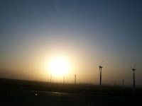
San Gorgonio Pass is the perfect confluence of geology, geography, and meteorology. The Pass itself is the result of fault blocking due to the San Andreas fault that runs and branches through here. On the south side, San Jacinto Mountain seems to rise straight up from the desert floor; on the north the San Gorgonio Mountains are large bulking presence, "Old Grayback". The Pass creates a funnel for the wind (and the reason for the wind farm). To the west lie the coastal valleys that lead eventually to the ocean. Wet cooler air from the west meets the dry air of the desert in the pass, and makes this a great place for dense fog, hail storms, snow, and rainbows.
I turn on my headlights as the clouds darken the sky, and the first drops of rain hit the windshield.


Comments
Post a Comment
The topic is the bolded sentence at the beginning of each post. Comments should pertain to that subject. Something more than "Like" or "You're wrong" is requested.